
Indonesia Earthquake: Magnitude 7.7 Quake Kills 51 in Flores
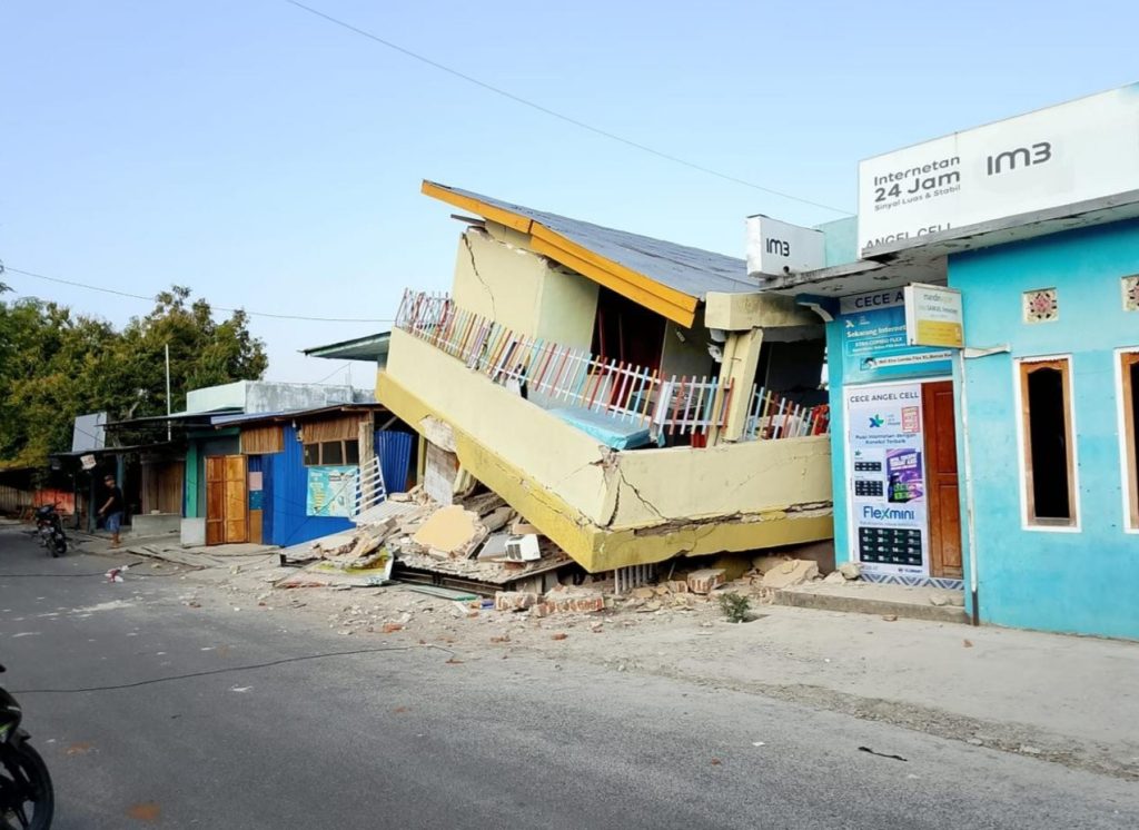
A magnitude 7.7 earthquake struck off Flores Island in Indonesia’s East Nusa Tenggara province before dawn on Saturday, 16 August 2026, killing at least 51 people and displacing thousands as rescue teams struggled to reach cut-off villages through landslide-blocked roads.
What happened
| Detail | Information |
|---|---|
| Magnitude | 7.7 |
| Time | 5:58am local time, 16 August 2026 |
| Depth | 10km (6.2 miles) |
| Epicentre | ~68km north-northwest of Ende city, Flores Island |
| Deaths | At least 51 |
| Injured | 36 seriously, 77 with minor injuries |
| Aftershocks | 341 recorded |
A tsunami warning was issued immediately after the quake and later lifted. The shallow depth — just 10km — is a key reason the shaking was so destructive over such a wide area; shallow earthquakes transmit more energy to the surface than deeper ones of the same magnitude.
Damage and displacement
- Over 1,300 homes damaged across the affected region.
- At least 157 houses destroyed outright, with nearly 200 more damaged.
- Around 5,000 people evacuated, including more than 3,300 in Sikka regency who fled their homes or were left stranded.
- 20 petrol stations shut down due to power outages.
- Roads blocked by landslides and communications disrupted in several areas, slowing the relief effort.
The rescue operation
Indonesian authorities have mobilised more than 3,500 military and police personnel, alongside three helicopters and one rescue vessel, to reach affected communities. Teams have been attempting to reach the remote Nagekeo regency by ferry after road access was cut off by the quake and subsequent landslides.
Why this region is so vulnerable
Flores Island sits within Indonesia’s stretch of the Pacific “Ring of Fire,” where the collision of tectonic plates makes powerful, shallow earthquakes a recurring risk. The area’s history underscores the danger: a 1992 earthquake in the same region triggered a tsunami that, combined with the quake itself, killed more than 2,500 people — a scale of loss officials are working urgently to avoid repeating this time.
The wider picture
Indonesia sits at the convergence of several tectonic plates and records some of the world’s most frequent significant earthquakes. Events of this scale routinely test disaster-response capacity in areas with dispersed island populations and limited road networks — a challenge distinct from, but comparable in kind to, the infrastructure strain seen during Europe’s recent heatwave, where a different kind of natural-hazard shock exposed gaps in grid and emergency capacity.
Frequently asked questions
Where exactly did the Indonesia earthquake strike?
The epicentre was about 68km north-northwest of Ende city on Flores Island, in Indonesia’s East Nusa Tenggara province, at a shallow depth of roughly 10km.
Was there a tsunami?
A tsunami warning was issued immediately after the 7.7-magnitude quake but was subsequently lifted without a major tsunami materialising.
How many people have died or been displaced?
At least 51 people have been confirmed dead, with 36 seriously injured and 77 with minor injuries. Around 5,000 people have been evacuated, with figures expected to be revised as rescue teams reach more remote areas.
Casualty and damage figures as reported by Indonesian disaster management authorities and international wire services, current as of 16 August 2026. Death tolls from major earthquakes are frequently revised upward in the days after the event as rescue teams reach isolated areas — check official Indonesian BNPB updates for the latest figures.
Related reading: Europe’s heatwave power crunch · Strait of Hormuz and Pakistan’s petrol prices