
BREAKING NEWS
Advertise with us >

Midwest Flooding: Indiana Declares Statewide Disaster Emergency

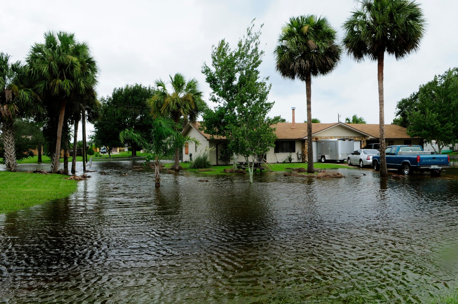
Flooded street in the Midwest United States during the 2026 Indiana flooding disaster

Indiana Governor Mike Braun has declared a statewide disaster emergency as catastrophic flooding kills at least three people and forces dozens of rescues, with more severe storms forecast through the weekend across Indiana, Ohio, Kentucky, Iowa and North Carolina.

What happened

A stalled weather system dumped rain at rates of 1 to 2 inches per hour over the same areas for extended periods this week, overwhelming rivers and streets across the Midwest. Indiana has been hit hardest so far.

DetailInformation
States affectedIndiana, Ohio, Kentucky, Iowa, North Carolina
Deaths (Indiana, this week)At least 3
Missing1 (of 4 who entered the Mississinewa River in Delaware County; 3 rescued)
Rainfall intensity1–2 inches per hour, stationary storms
Emergency declarationStatewide, Indiana, declared by Gov. Mike Braun

Where the damage is worst

  • Henry County: Floodwaters reached rooftops of homes; a street collapsed; over 50 people were rescued from a flooded apartment complex.
  • New Castle: The roof was torn off a commercial building.
  • Cambridge City: A 7–8 block area was evacuated by boat as streets became impassable.
  • Munster: Massive trees were uprooted by storm winds.
  • Dearborn and Hamilton counties: Evacuation orders issued for residents along the Whitewater River.

The governor’s response

Announcing the statewide disaster declaration, Governor Braun said: “Hoosiers’ safety is my top priority. Our state response is fully mobilized.” The declaration clears the way for state resources to support local emergency response and typically precedes a request for federal disaster assistance, though that request had not been confirmed at the time of writing.

What’s forecast next

Meteorologists warned of additional severe storms bringing damaging winds, large hail and the possibility of tornadoes moving into the weekend. Compounding the risk, a heat dome is expected to push heat indices to 110–111°F across the Mid-South region even as flood recovery continues — a dangerous combination for rescue crews and displaced residents alike.

Why storms are stalling like this

The flooding follows a pattern meteorologists have flagged in other major floods this year, including the Indonesia earthquake and disaster response covered separately: slow-moving or stationary weather systems repeatedly drenching the same locations rather than moving through quickly. When a front stalls, even moderate hourly rainfall rates compound into extreme multi-day totals, which is what has pushed Midwest rivers like the Mississinewa and Whitewater beyond their banks this week.

Frequently asked questions

How many people have died in the Midwest flooding?

At least three storm-related deaths have been confirmed in Indiana this week, with one person still missing after four people entered the Mississinewa River in Delaware County.

Which US states are affected by the flooding?

Indiana, Ohio, Kentucky, Iowa and North Carolina have all reported flooding impacts, with Indiana the worst affected so far.

Has Indiana received federal disaster aid?

Governor Braun’s statewide disaster declaration is a step that typically precedes a formal federal aid request. Confirmation of federal assistance had not been reported at the time of writing — check official Indiana and FEMA channels for updates.


Casualty figures, rainfall data and official statements as reported by US news wires and the Indiana governor’s office, current as of 15–16 August 2026. Flood conditions are changing rapidly — check official Indiana Department of Homeland Security and National Weather Service updates for the latest.

Related reading: Indonesia’s magnitude 7.7 earthquake
Indonesia Earthquake: Magnitude 7.7 Quake Kills 51 in Flores

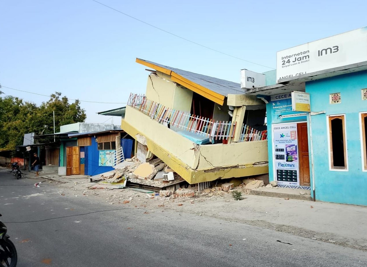
Damaged building after the magnitude 7.7 Flores Island earthquake in Indonesia

A magnitude 7.7 earthquake struck off Flores Island in Indonesia’s East Nusa Tenggara province before dawn on Saturday, 16 August 2026, killing at least 51 people and displacing thousands as rescue teams struggled to reach cut-off villages through landslide-blocked roads.

What happened

DetailInformation
Magnitude7.7
Time5:58am local time, 16 August 2026
Depth10km (6.2 miles)
Epicentre~68km north-northwest of Ende city, Flores Island
DeathsAt least 51
Injured36 seriously, 77 with minor injuries
Aftershocks341 recorded

A tsunami warning was issued immediately after the quake and later lifted. The shallow depth — just 10km — is a key reason the shaking was so destructive over such a wide area; shallow earthquakes transmit more energy to the surface than deeper ones of the same magnitude.

Damage and displacement

  • Over 1,300 homes damaged across the affected region.
  • At least 157 houses destroyed outright, with nearly 200 more damaged.
  • Around 5,000 people evacuated, including more than 3,300 in Sikka regency who fled their homes or were left stranded.
  • 20 petrol stations shut down due to power outages.
  • Roads blocked by landslides and communications disrupted in several areas, slowing the relief effort.

The rescue operation

Indonesian authorities have mobilised more than 3,500 military and police personnel, alongside three helicopters and one rescue vessel, to reach affected communities. Teams have been attempting to reach the remote Nagekeo regency by ferry after road access was cut off by the quake and subsequent landslides.

Why this region is so vulnerable

Flores Island sits within Indonesia’s stretch of the Pacific “Ring of Fire,” where the collision of tectonic plates makes powerful, shallow earthquakes a recurring risk. The area’s history underscores the danger: a 1992 earthquake in the same region triggered a tsunami that, combined with the quake itself, killed more than 2,500 people — a scale of loss officials are working urgently to avoid repeating this time.

The wider picture

Indonesia sits at the convergence of several tectonic plates and records some of the world’s most frequent significant earthquakes. Events of this scale routinely test disaster-response capacity in areas with dispersed island populations and limited road networks — a challenge distinct from, but comparable in kind to, the infrastructure strain seen during Europe’s recent heatwave, where a different kind of natural-hazard shock exposed gaps in grid and emergency capacity.

Frequently asked questions

Where exactly did the Indonesia earthquake strike?

The epicentre was about 68km north-northwest of Ende city on Flores Island, in Indonesia’s East Nusa Tenggara province, at a shallow depth of roughly 10km.

Was there a tsunami?

A tsunami warning was issued immediately after the 7.7-magnitude quake but was subsequently lifted without a major tsunami materialising.

How many people have died or been displaced?

At least 51 people have been confirmed dead, with 36 seriously injured and 77 with minor injuries. Around 5,000 people have been evacuated, with figures expected to be revised as rescue teams reach more remote areas.


Casualty and damage figures as reported by Indonesian disaster management authorities and international wire services, current as of 16 August 2026. Death tolls from major earthquakes are frequently revised upward in the days after the event as rescue teams reach isolated areas — check official Indonesian BNPB updates for the latest figures.

Related reading: Europe’s heatwave power crunch · Strait of Hormuz and Pakistan’s petrol prices